Proof you went,without saying a word.
The route, the distance and the weather, attached to the report card.
A real moment
The question that stops being asked
A newer client is quietly unsure whether the full hour really happened. You never have that conversation, because the report card already carries the route you walked, the distance, and the weather at the time. After the second week they stop looking, which is the actual goal.
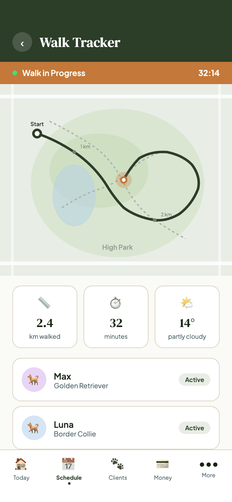
The route records itself
Start the walk and Chester tracks it, filtering out poor readings and skipping redundant points so the line is clean.
It survives a dying phone
The session is backed up locally every thirty seconds, so a crash mid-walk does not lose the route.
It arrives where it matters
Route, distance and weather attach to the report card, so the proof and the update are the same thing.
Everything GPS Walk Tracking does
- Real-time location tracking during active walks
- Automatic distance computation in kilometers
- Full GPS route history stored with every walk
- Accuracy filtering: discards low-quality readings automatically
- Smart deduplication: skips redundant points for clean routes
- Crash recovery: session backed up locally every 30 seconds
- Weather and environmental context captured at service start
- Route and distance attached to report card on completion
GPS capture is available in the Chester mobile app. The web app displays a completed route but cannot record one, because a browser cannot track a walk.
Built for dog walkers.
Ready to Try GPS Walk Tracking?
Get started free. No credit card required.